
#MH370
Kementerian Pengangkutan Malaysia
Since their government and ministry will not provide any useful data, we have the data they have already published…

#MH370
Kementerian Pengangkutan Malaysia
Since their government and ministry will not provide any useful data, we have the data they have already published…
Limited redirecting information from governments and corporations leaves us lost
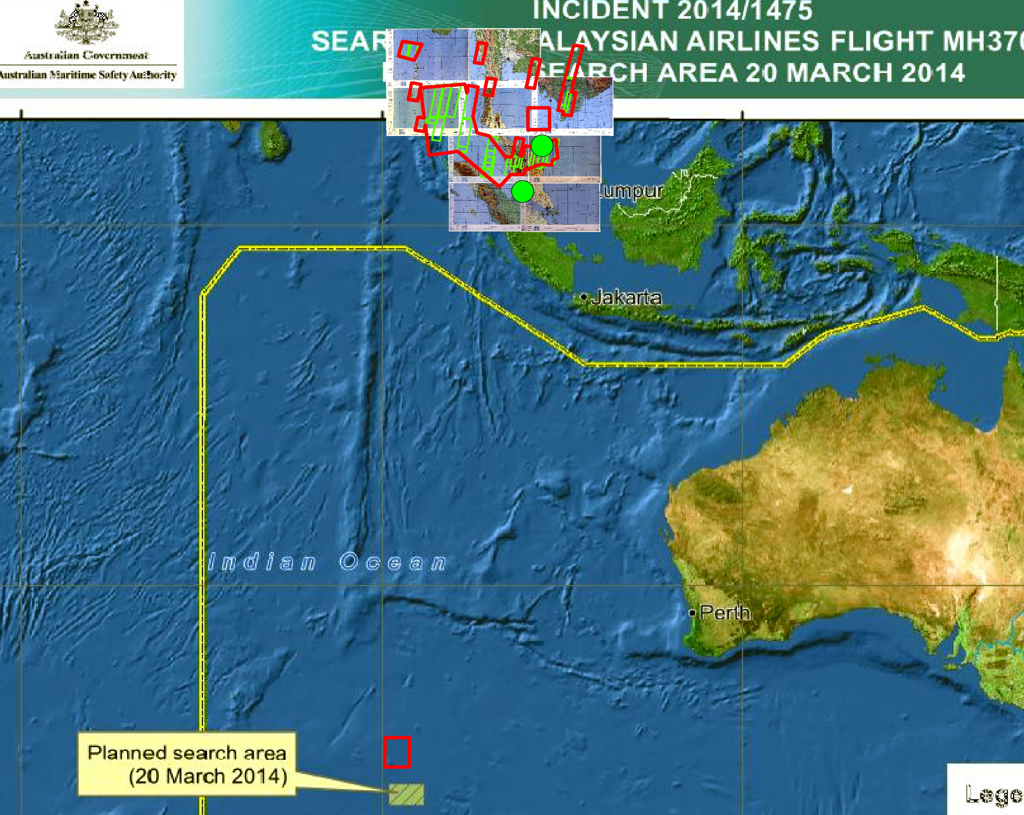
por favor, publica enlaces, las coordenadas geoespaciales conocidos

IFR Enroute Aeronautical Charts and Planning
http://aeronav.faa.gov/enroute/02-06-2014/porc_pdf.zip
1:500,000 Scale Tactical Pilotage Chart Series
http://www.lib.utexas.edu/maps/tpc/europe-asia-africa-index.html
Southern Vietnam 1:250,000 JOG
Click to access nc-4815_geo.pdf
Largest Open Airports Database:
Imagery:
http://www.blackbridge.com/rapideye/news/action/malaysiaair.html
http://www.tomnod.com/nod/ **Note users claim slow speed and cannot connect**
DAFIF shapefile data:
http://geodata.pdc.org/geodata/world/runways_poly.zip
http://geodata.pdc.org/geodata/world/runways_point.zip
Malay Govt as of 3/11/14:

Software:
http://www.qgis.org/en/site/forusers/download.html
Updated Docs:
https://docs.google.com/spreadsheet/ccc?key=0AnWOaQwrCb5cdGNmMkQxd2RrV1RPTkZzZE1TV1UwQWc#gid=0
Passenger List:
Click to access Malaysia%20Airlines%20Flight%20MH%20370%20Passenger%20Manifest_Nationality.pdf
Indonesia Peta:


