

Monthly Archives: August 2016
Nicaragua Oil Spill


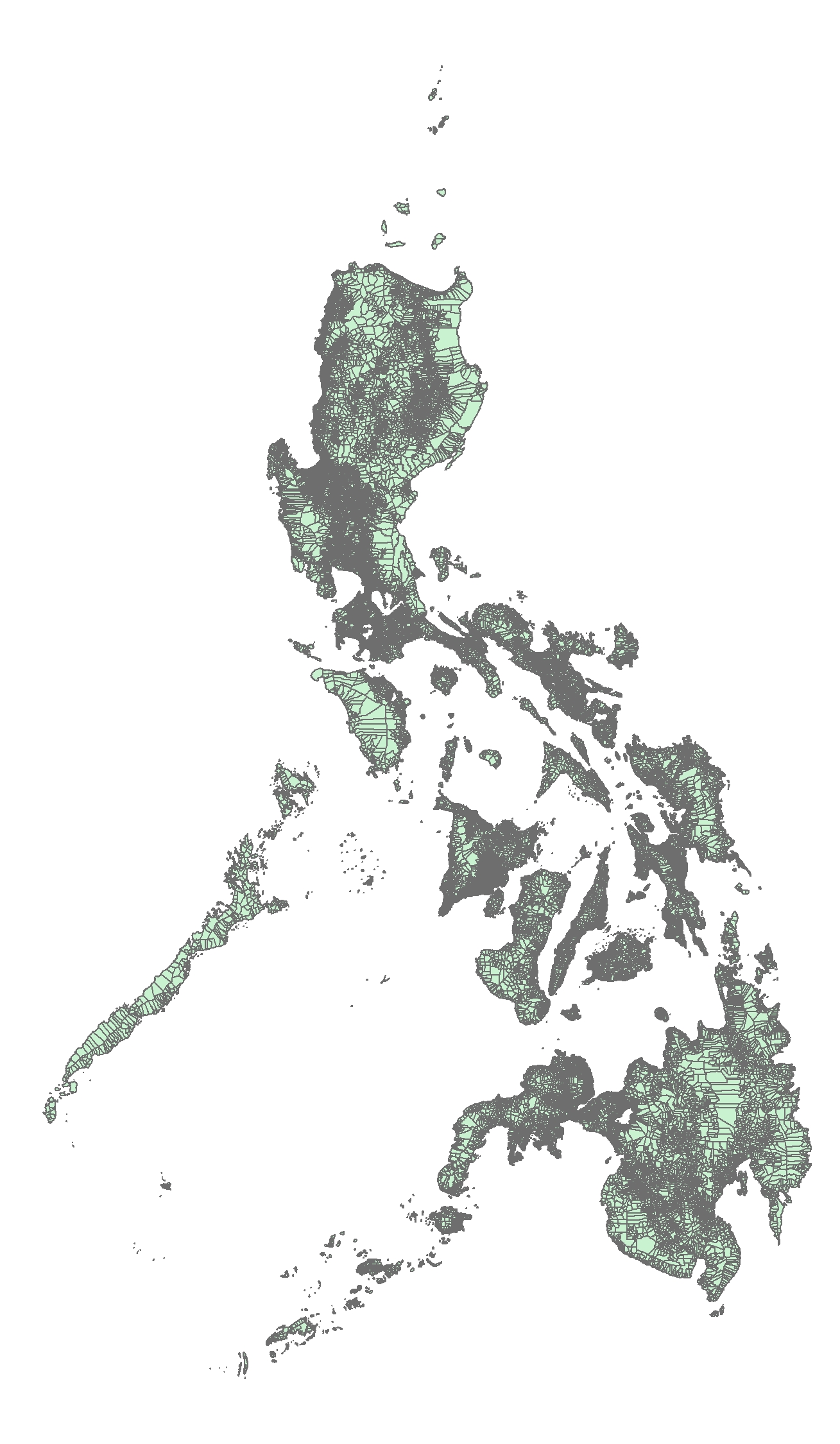
Philippines Barangay Shapefile
Time to replace GADM
gadm-blue
new admins-red


landsat image source: https://s3-us-west-2.amazonaws.com/landsat-pds/L8/116/050/LC81160502016044LGN00/index.html
composite bands 6,5,4
Rio 2016 Olympics 08/17/2016

datos abiertos Nicaragua
Nicaragua shapefile data


coming soon: https://github.com/justinelliotmeyers/official_nicaragua_administrative_boundary_shapefile
landsat 8 aws 08152016

Madeira Before After
07/26/2016 last quality landsat 8 image – http://earthexplorer.usgs.gov/fgdc/4923/LC82080372016208LGN00

08/11/2016 latest landsat 8 – http://earthexplorer.usgs.gov/fgdc/4923/LC82080372016224LGN00

Portugal Administrative Boundaries: http://www.dgterritorio.pt/cartografia_e_geodesia/cartografia/carta_administrativa_oficial_de_portugal__caop_/caop__download_/
*(Madeira http://www.dgterritorio.pt/ficheiros/cadastro/caop/caop_download/arqmadeiraaadcaop2015 )
SRTM1

http://earthexplorer.usgs.gov/metadata/8360/SRTM1N32W017V3/
http://earthexplorer.usgs.gov/metadata/8360/SRTM1N32W018V3/
census shapefile data:

http://mapas.ine.pt/download/index2011.phtml
(*Madeira http://mapas.ine.pt/download/files/2011/ram2011.zip )
srtm 1 arc second global

2016 Tiger Shapefile Data


ftp://ftp2.census.gov/geo/tiger/TIGER2016/
